
Friday, December 18, 2015
Le pouvoir de la cartographie participative en 3D chez les Saramacas du Suriname (video)
Il y a cinquante ans, quelque 5000 individus du peuple Saramaccan du Suriname ont dû quitter leurs terres traditionnelles, le long de la Rivière Suriname en raison de la construction d'un grand barrage. Les blessures de cette transmigration se font encore sentir aujourd'hui. Pendant ce temps, les Saramaccans qui vivent dans cette région font face à de nouveaux défis, car leurs droits territoriaux ne sont pas encore officiellement reconnus et les infrastructures routières pour accéder à la zone sont en voie d'amélioration. La création d'une maquette participative de la zone qui visualise et documente leurs traditions et l'utilisation traditionnelle des ressources contribue à surmonter leur frustration et leur redonner espoir.
English version: http://goo.gl/hS5nKb
Saamaka version: http://goo.gl/9XC2Jb
The enabling power of participatory 3D mapping among the Saramaccan Peoples of Suriname (Video)
Fifty years ago, some 5000 Saramaccan Peoples of Suriname had to leave their traditional lands along the Suriname River due to the construction of a major dam. The wounds of this transmigration are still felt today. Meanwhile, the Saramaccans who live in the Upper Suriname River area face new challenges since their territorial rights are not yet officially recognized and road infrastructure to access the area is improving. Creating a 3D model of the area that tells the inside story of their traditions and land use can help them to overcome their sense of being misunderstood by decision-makers and rediscover their voice.
Language versions:
Version française: http://goo.gl/ggXyw5
Saramaccan version: http://goo.gl/9XC2Jb
The 15 min video production "The enabling power of participatory 3D mapping among the Saramaccan People of Suriname" has been launched on October 9 at the 13th Caribbean Week of Agriculture in Paramaribo. The launch occurred during the session "Maps as media in policy processes: Bringing the 3rd dimension to the negotiating table" in the presence of representatives from the Saramaccan community.
The launch was followed by reflections done by Saramaccan representatives Mr Godfried Adjako, one of the captains of the village of Kaajapati, and Ms Debora Linga who spent her infancy with her grandparents on their farm on the shores of the Brokopondo Reservoir and later on kept visiting them in Ginginston village along the banks of the Upper Suriname River.
Mr Godfried Adjako recalled that in the process of populating the 3D model the community, especially the youth, learned a lot from the elders. "The map now shows our life, the Earth we live on, the Earth we walk on, the Earth without which we cannot live."
"We can use the map to take decisions on where to locate future developments", he added. Both men and women contributed to the map. "Women know a lot about the surrounding of the villages, while men who use to go hunting, know the most about far away areas."
Mr Adjako stated that when developing the legend ahead of the mapping exercise, the community decided to omit sensitive and confidential information. Therefore the data contained in the model and currently being digitised by Tropenbos international Suriname should be considered as publicly available.
The P3DM process has been a discovery journey for young Debora. "In the 60's my grandparents had to resettle because their village had been submerged by the rising waters of the Brokopondo Reservoir . They resettled along the Upper Suriname River in a village called Ginginston where I grew up. I could not understand the reason why my grandfather kept on navigating a long way along the river to reach the shores of the lake where he was growing watermelon" she said. "I discovered the reason while chatting with an elder who explained to me that transmigrating families were welcome by Saramaccan villages uphill the lake, but were granted limited access to resources. In fact they were sort of borrowing the land from people who occupied it for generations. Thus they only had access to small farming areas. In Saramaccan this is how you feel: they were living on somebody else's land."
Friday, December 11, 2015
Socially engaging, user-friendly, and user-useful approaches in ecosystem service research
Participatory 3D modelling was presented as a ground breaking approach to use in participatory ecosystem service research during the 8th Ecosystem Service Partnership Conference, held in Stellenbosch, South Africa from the 9th to the 13th of November 2015. The Conference saw the participation of around 380 scientists from around the globe.
The presentation by Sara Ramirez A socially engaging, user friendly and user-inspired approach in ecosystem research took place within the workshop “Indigenous peoples in their ecosystems’’. An ecosystem service research project was designed and implemented in Suriname, which used Participatory 3D Modelling (P3DM) to engage local communities in a process of co-producing knowledge about ecosystem services and competing land uses.
P3DM is an effective tool to involve scientist and local knowledge holders in an equally and transparent co-production of salient and legitimate knowledge about ecosystem services. Parallel to research outputs (of main interest to the researcher), a P3DM approach yields directly tangible outputs for the local communities which makes research inclusive and legitimate. Attendees during the session participated actively through questions and feedback.
Friday, November 06, 2015
Facilitating climate smart adaptation through the use of Participatory 3D Modelling by Neila Bobb-Prescott at the Caribbean-Pacific Agri-Food Forum in Barbados
#CPAF15 - Facilitating climate smart adaptation through the use of Participatory 3D Mapping from CTA
Participatory 3D Modelling or P3DM in short, is a community-based mapping method which is spreading in the Caribbean Region. It facilitates planning and action-taking on climate change related issues. Considering the potentials of the process, efforts are needed to promote the success stories of its use to date. This presentation at the Caribbean Pacific Agri-Food Forum in Barbados (206 November 2015) is an important step in promoting the practice in the region.Neila Bobb-Prescott's participation in the 2nd Agribusiness Forum has been supported by the Technical Centre for Agricultural and Rural Cooperation ACP-EU (CTA)
Participatory mapping processes for data generation and exchange in SIDS by Aly DeGraff at the Caribbean-Pacific Agri-Food Forum in Barbados
Participatory mapping is the solicitation and incorporation of geospatially focused local knowledge in bottom-up decision-making processes. It provides a wide decision-making base, taking into consideration the collaborative collection and validation of data while building ownership in the generated data. Participatory mapping can be used as a powerful tool to strengthen public participation in governance and social change in agribusiness communities.
Aly DeGraff delivered her talk at the Caribbean-Pacific Agri-Food Forum in Barbados organised by CTA and partners.
Tuesday, November 03, 2015
L’équipe samoane de cartographie participative a reçu un prix de développement durable

Le projet ICCRIFS Project s’étale sur une durée de quatre ans et est financé par le Fonds pour l’environnement mondial (FEM, GEF en anglais) via le le programme des Nations Unies pour le développement (PNUD). L’objectif du projet est d’intégrer les risques liés au changement climatique dans la gestion des forêts aux Samoa. Après une formation organisée en 2012 par le Centre technique de coopération agricole et rurale (CTA) portant sur l’utilisation de la modélisation participative en trois dimensions (MP3D), les équipes du projet ICCRIFS ont mis sur pied 18 exercices de MP3D à l’intention des communautés locales dans des domaines comme la gestion de l’eau, des forêts et le tourisme. Le premier modèle participatif en trois dimensions qui a été mis en œuvre (il couvrait les villages s’étendant de Laulii à Falevao) est devenu un outil de plannification très efficace. Il a permis d’impliquer les gens en leur apportant des connaissances et des compétences en matière de gestion de l’environnement et en leur fournissant des outils pour s’adapter au changement climatique et en réduire les effets.
La remise des prix de l’innovation et de l’excellence dans la fonction publique a eu lieu le 25 septembre dans le cadre de la quatrième journée de la fonction publique. Cette journée est organisée pour commémorer, célébrer et reconnaître la contribution et le rôle de la fonction publique en vue du développement national des Samoa. Près de 50 ministères gouvernementaux et d’organismes publics ont pris part aux célébrations cette année.

Le grand public ainsi que les établissements scolaires étaient invités à cette occasion à communiquer avec les agences gouvernementales afin d’avoir une meilleure compréhension de leur rôle et de leurs fonctions, ainsi que de la manière dont ces agences ont une influence sur la vie de tous les jours.
Thursday, October 29, 2015
Samoa’s Ministry of Natural Resources and Environment receives award for engaging civil society via participatory mapping

The ICCRIFS Project is a 4 year project funded by the Global Environment Facility (GEF) through the United Nations Development Program (UNDP). The goal of the project is to integrate climate change risks into forestry management in Samoa. After being trained by the Technical Centre for Agriculture and Rural Development (CTA) in practising Participatory Three-Dimensional Modelling (P3DM) in 2012, staff of the ICCRIFS Project successfully facilitated a total of 18 P3DM exercises with communities in various sectors including water, forestry, tourism. The first P3D Model to be implemented (covering villages from Laulii to Falevao) became a very effective planning tool. It helped engaging the community by building capacity, knowledge and skills on environmental management, and ways to adapt and mitigate climate change.

These Awards are used to recognize the dedication of public servants in achieving their respective Ministry’s and Office’s objectives. Nominations of potential awardees were solicited from the general public in August and were thereafter assessed by an independent panel consisting of 3 members: the Chamber of Commerce President on behalf of the private sector, SUNGO Interim President Vaasilifiti Moelagi Jackson on behalf of the civil society, and the Chairman of the Commission.
The general public as well as schools were invited to take advantage of the opportunity to engage with Government agencies to gain an in-depth understanding of the functions and roles of each of the participating agencies and how these relate to their everyday life.
Related post: Top UN officials Helen Clark and Naoko Ishii praising outcome of P3DM activities in Samoa
More information on the P3DM process and case studies are found here and here.
Wednesday, October 21, 2015
Community-based Disaster Risk Reduction in the Philippines
With the support of UNICEF and the University of the Philippines, children in Camarines Norte help their communities in locating the hazard risks in their areas and plan disaster preparedness measures using a Participatory 3D Model (P3DM).
Sunday, September 20, 2015
Drones and Aerial Observation : New Technologies for Property Rights, Human Rights, and Global Development

More information on New America
We have wings to fly - Join the uav4ag community
The use of unmanned aerial vehicles (UAVs) or drones for management of crops, livestock, fisheries, forests and other natural resource-based activities represents a new technological frontier and opens up a range of exciting opportunities. UAVs offer also opportunities for grassroots’ involvement in monitoring use of and access to the resources their livelihoods depend on.

A community has been established on www.uav4ag.org to cater for practitioners, researchers, farmers, entrepreneurs, service providers operating in developing countries and who are interested in the topic. Members of the community share their experiences in developing UAV technologies and related software applications and more importantly in making use of small UAVs to improve the assessment and management of crops, fishing grounds and other resource-based activities. Relevant events, capacity building opportunities and other resources are signalled as soon as these are known by members of the community.
Being the use of UAVs for agricultural purposes a recent phenomenon, national aviation authorities and potential users are facing new challenges linked to the use of UAVs within their skies. Hence this Community focuses also on existing and forthcoming policies, laws and regulations governing their use.
Thursday, September 17, 2015
Rainforest Airforce: Indigenous Peoples Fly Drones to Protect their Land
In August 2014, Tushevs Aerials (tushevs.com) traveled deep in the Peruvan Amazon to train indigenous leaders in the use of remote-control airplanes for the protection and monitoring of their rainforest. The workshop was hosted by AIDESEP, the country's largest indigenous peoples' network, with participants from the Loreto and Madre de Dios Amazon provinces, as well as from the Panama's Embera peoples. This technology enables communities to monitor and defend their territories against legal and illegal pressures.
These are some images from the weeklong workshop, as well as raw footage that the drone captured while flying over the Pacaya-Samiria National Park in the Loreto Province of Peru.
The music is a regional song called El LLanto del Ayaymama and speaks of a local legend of two abandoned children who the forest spirits save by giving them wings.
Source: YouTube
Thursday, September 10, 2015
The Transformative Power of Social Media in Agriculture: Inspiring Stories

The booklet documents a wide range of practical applications for Web 2.0 and social media in ACP settings. Some farmers have found that Facebook can be an excellent marketing channel to promote their products. Extension agents are discovering that social media is a highly effective way of communicating with the people they serve. Agricultural organisations are using a range of social media tools to mount advocacy campaigns aimed at influencing policy-makers. Researchers are using online collaboration tools to work on joint publications, while more and more young people are using new ICT skills to blog about important rural development issues. Others are seizing opportunities to develop innovative online services and launch their own companies as agripreneurs.
“Social media has become part of everyday life for most people in the developed world. But it has created a life-changing experience for many people in rural areas who have come to use it,” said CTA Director Michael Hailu.
All the stories featured in the booklet revolve around people who have benefited from a CTA-led campaign to make Web 2.0 and social media tools more accessible to agriculture and rural development actors in ACP countries.
The figures speak volumes: more than 4,000 individuals trained, 176 face-to-face training events – known as Web 2.0 and social media learning opportunities (LOs) – held in 44 ACP countries. In 2013, the Web 2.0 and social media LOs carried off the prestigious World Summit on the Information Society (WSIS) Project Prize in the e-Agriculture category.
Impact assessment studies conducted by CTA have revealed that its Web 2.0 and social media capacity-building activities have led to greater inclusion and empowerment for participants, often with far-reaching repercussions for themselves and the people with whom they interact. Adoption rates are high, with young women emerging as the most likely players to adopt social media, following a training course.
In Uganda, local NGOs are using ICTs to support producers, processors and other actors in agricultural value chains. Agronomists from Madagascar are using Web 2.0 and social media to develop knowledge about apiculture. In Central Africa, a farmers’ network institutionalised social media and improved its operational effectiveness. In Samoa, a Facebook and Twitter marketing campaign is producing impressive results for women weavers of ceremonial mats. And in the Caribbean, bloggers and social media reporters are helping other young people to plan a future in farming.
“Many people have told us that the training sessions have not only changed their working behaviour, but their whole lives,” said Giacomo Rambaldi, Senior Programme Coordinator at CTA.
The official launch of the CTA publication will be held on 26 November 2015 during the International Day of Vrije University (VU) in Amsterdam.
The booklet is available for order in print form or for free download from the CTA publications catalogue
Sunday, August 30, 2015
The power of media: Did the documentary film "Virunga" trigger a plunge in the share price of the oil exploration firm SOCO International?
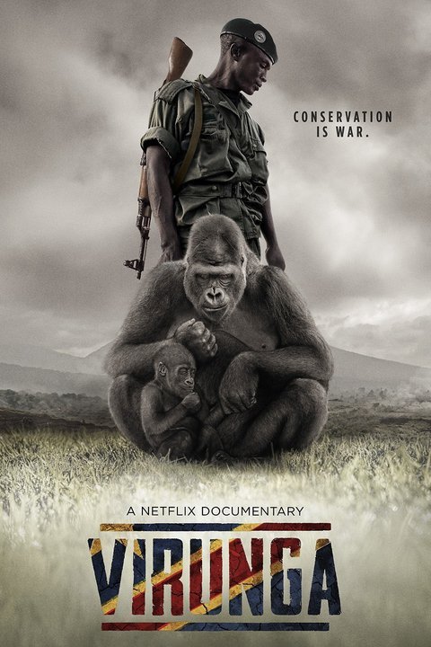
The film premiered at the Tribeca Film Festival on April 17, 2014. Since airing on Netflix it was nominated for an Academy Award for Best Documentary Feature.
The allegations brought against Soco International by the documentary, and supported by local NGOs and civil society organizations working in and around Virunga National park, put increased pressure on the company to put an end to its exploration for oil within the protected World Heritage Site.
On June 11, 2014, Soco International and the WWF announced a joint statement in which the oil company committed "not to undertake or commission any exploratory or other drilling within Virunga National Park unless UNESCO and the DRC government agree that such activities are not incompatible with its World Heritage status". This was widely cited as a victory for WWF, which had long been campaigning for Soco to leave the region, and credit was also given to the filmmakers. However, strong concerns about the credibility of this agreement were raised by the filmmakers, alongside other NGOs such as Global Witness and Human Rights Watch, and local civil society organisations.
World Wildlife Fund executives now acknowledge that the battle over Virunga is hardly over. SOCO has yet to relinquish its operating permits or commit to an unconditional withdrawal…”They’re leaving the door open,” said Zach Abraham, director of the World Wildlife Fund’s global campaigns. (Source: adapted from Wikipedia)
On March 13, 2015, BBC reported that the Democratic Republic of Congo says it wants to redraw the boundaries of Virunga National Park, to allow for oil exploration.
On June 10, 2015 BBC reported that 'Soco paid Congo major' accused of Virunga oil intimidation.
Since the launch of the film on April 17, 2014, SOCO's share price has plunged by 63.33%. This slump can be attributed only partially to the drop in oil prices as shares from BP and Shell dropped by 14.3% and 25.9% respectively over the same period.

You can view the documentary film on Netflix.
You can interact with the producers via http://virungamovie.com/ and take action.
Save Virunga: http://savevirunga.com/
Watch trailer:
Heads up to Orlando von Einsiede, the film director, the French investigative journalist, Mélanie Gouby and to the team behind this great production!
Sunday, August 23, 2015
Mapping Our Land: A Guide to Making Your Own Maps of Communities and Traditional Lands
 Communities all over the world are discovering that maps provide a valuable tool for recording local knowledge and discussing land-use issues. In a participatory approach to mapping, community members design the mapping project and make maps according to their own needs.
Mapping Our Land
Alix Flavelle has taught mapping to aboriginal peoples around the world. She outlines the range of themes that communities choose to address and offers examples of how they have presented their local knowledge on maps. A variety of map-making techniques are explored, as well as guidelines for choosing which techniques best suit the purpose of the mapping project.
Clear step-by-step instructions are provided for:
- Basic principles of map-making
- Exploring cultural elements of maps
- How to organize the community
- Making sketch maps on paper or mylar
- Using topographic maps
- Making three-dimensional models
- How to do a compass survey
- Using a Global Positioning System (GPS)
- Interpreting aerial, radar and satellite images
- Drawing the final map
- Land rights, resource management and protecting local knowledge.
Accessible and full of practical information and ideas, this book is a toolbox intended to help communities design and complete a mapping project that fits their unique culture, landscape and situation, and their purpose for making maps.
Available from Amazon: Mapping Our Land
Handbook on Participatory Land Use Planning: Methods and tools developed and tested in Viengkham District, Luang Prabang Province, Lao PDR

Securing land tenure rights for village communities through participatory land use planning is a hot topic for policy makers, researchers and development practitioners. In Lao PDR, the government policy aimed at turning land into capital may well turn to land grabbing wherever local communities are not informed about their rights and are not involved in land use planning.
Participatory Land Use Planning (PLUP) is an empowerment process for villagers who get trained as land use negotiators. They learn the real value of their land and labour.
The proposed PLUP method helps them to visualize land related issues, to assess the potential impact of alternative scenarios before they make decision. While local people know well their own situation they often do not know how to collectively design a better future for the whole village through land use planning. ‘PLUP fiction’ is a learning device for land zoning and local development planning. Based on a virtual village territory visualized on a board, members of the village land management committee learn how to make informed decisions about land zoning according to the needs of different stakeholders.
Using the method learned during the landscape simulation game, they negotiate their own land use zoning on the 3D model representing their village landscape. They first design their current land use by using coloured pins and string on the 3D model. Then, land zones are digitized, analyzed and compared to the needs expressed by the villagers in their village action plan, i.e. village economic development, labour force availability, rice sufficiency, livestock carrying capacity, preservation of ecosystems services.
New land use plans are designed successively until all the committee members are satisfied. The iterative zoning process is facilitated by the use of a GIS software (QGIS) and an Excel based tool. On completion of the PLUP exercise, the 3D model painted with the new land use plan remains with the community.
The purpose of this PLUP Handbook is to provide practical tools and methods for PLUP implementation based on experiments conducted in Viengkham District, Luang Prabang Province. Lessons drawn from this experience have been gradually incorporated into the tools and procedures described in this Handbook and Toolbox as a reference guide for PLUP practitioners.
Download: Handbook on Participatory Land Use Planning: Methods and tools developed and tested in Viengkham District, Luang Prabang Province, Lao PDR
Authors: Jean-Christophe Castella, Jeremy Bourgoin, Lionel Cottet, Maëlle Drouillat, Khamla Nanthavong, Sangthong Phatsalin, Guillaume Lestrelin, Bounthanom Bouahom and Manithaithip Thepphavanh
Publisher: National Agriculture and Forestry Research Institute (NAFRI), Institute of Research for Development (IRD) and Centre for International Forestry Research (CIFOR), May 2012
Saturday, August 22, 2015
Participatory Methods in Community-based Coastal Resource Management

Download the chapter on Resource Mapping
ISBN: 0-942717-90-2
Publisher: International Institute for Rural reconstruction (IIRR), 1998
The Canadian International Development Agency (CIDA), International Development Research Centre (IDRC), Royal Netherlands Embassy, Small Islands Agricultural Support Services Programme (SMISLE) and the Western Samar Agricultural Resources Development Programme were the funding partners for this publication. Collaborating organizations were IDRC, International Center for Living Aquatic Resources and Management (ICLARM), Voluntary Service Overseas (VSO), SEAMEO Regional Center for Graduate Study and Research in Agriculture (SEARCA), SMISLE and Coastal Resource Management Project (CRMP).
Wednesday, August 19, 2015
Mapping for Change: Practice, technologies and communication - 10 years have passed - publication still valid and available

The CD contains PDF versions of the articles published in PLA 54 translated in the following languages: Arabic, Bangla, Chinese (traditional and simplified), French, Hindi, Persian-Dari, Portuguese, Spanish, Swahili and Tamil as well as the English versions. The CD includes additional resources (mainly in English), including a video of the Conference and key literature on the practice, including UNESCO Conventions on Cultural Mapping.
Available (for free) to residents in Africa, Caribbean and Pacific (ACP) countries via CTA Publishing.
Credits for Translations, layout and typesetting
- Arabic: Translation by Dr. El-Hussaini Yehia, Center for Development Services, Cairo, with thanks to Ali Mokhtar
- Bangla: Translation by Enamul Huda and Taifur Rahman, PRA Promoters’ Society, Bangladesh
- Chinese (Simplified): Translation by Liu Xiaoqian, Yang Fang , Li Fang, Li Xiaoyun, China Agricultural University, Beijing
- Chinese (Traditional): Translation by Wang Yaohui, National Linkou Senior High School, Linkou Township, Taiwan with special thanks to Hsiao Ya Wen, National Changhua University of Education, Changhua City, Taiwan (Chapters 1 and 2); Lin Mei Jhih, Shengang Junior High School, Shengang Township, Taichung County, Taiwan (Chapter 4); Chuang Yu Chun, National Yangmei Senior High School, Yangmei Township, Taoyuan County, Taiwan (Chapter 7); Shen Tsui Mei, National Linkou Senior High School, Linkou Township, Taipei County, Taiwan (Chapter 9); Jhang Yu Jing, National Sihu Senior High School, Sihu Township, Changhua County, Taiwan (Chapter 12); Lin Wen-Xin, Kaohsiung Municipal Chung-Cheng Industrial Vocational High School, Cianjhen District, Kaohsiung City, Taiwan (Chapter 15)
- French: Translation by Maryck Nicolas, with thanks to Marie Jaecky of IIED for proofreading
- Hindi: Translation by Meera Jayaswal, with thanks to Dr. Neela Mukherjee, Director, Development Tracks, Delhi, India, and to Mr.K.K.Singh, Ujjawal Kumar and Sanjay Das for page layout and typesetting
- Persian-Dari: Translation by Reza Nobacht, with thanks to CENESTA, Tehran for technical support, to Esmaeel Hamidi and Jeyran Farvar for copy editing and proof reading, to Pooya Ghoddousi for coordination and Jeyran Farvar for page layout and typesetting
- Portuguese: Translation by Francis Sahadeo, with thanks to Ines Fortes for copyediting
- Spanish: Translation by María Isabel Sanz Bonino, with thanks to Alejandra Larrazábal and Mike McCall for copyediting and Tanya Pascual for proofreading
- Swahili: Translation by Catherine Wanjiku Gichingi and Margaret Njeri Gichingiri (ERMIS Africa) with thanks to Julius Muchemi, Executive Director and Bancy Wanjiru, Programme Administrator
- Tamil: Translation by John Devavaram and his team at SPEECH, Madurai, India, including Arunodayam
Saturday, August 08, 2015
Saamaka peoples upscale the use Participatory 3 Dimensional Modelling along the Upper Suriname River

Once GEF-SGP released the funds, a second P3DM exercise took place in June and July 2015. Areas that are important for the community’s way of life, particularly areas with high cultural and historical value were at the core of the process. Over an 11-day period, a total of ~65 representatives from 10 villages traveled to the village of Pikin Slee, to collectively determine a representative portion of Saamaka traditional land as a 3D physical map (built at a 1:15,000 scale).
 The map was conceived with the specific objective of empowering local communities to play an active role in sound land-use and sustainable development. Saamaka participants populated the 3D model with locations of ecosystem services and cultural and historical landscape of value. With this, P3DM is demonstrating its utility in both socio-ecological production landscape based research, as well as in collaborative historical, cultural and ethno-archaeology studies in Suriname.
In this context, Tropenbos International Suriname is collaborating with the History Department of the Anton de Kom University of Suriname, Faculty of Humanity so that historical and contemporary cultural landscape use and services are better portrayed.
Notes: The project is granted to the Association of Saamaka Authorities (VSG), executed by Tropenbos International Suriname and financially supported by the UNDP GEF Small Grants Programme. CTA supported the participation of 2 delegates from CARIBSAVE in the exercise to ensure wider replication of the process in the Caribbean region.
More on 2014 P3DM activities in Suriname:
- Suriname - 15 July, 2015. Mapping the livelihoods of the Saamaka people.
- Saramakan’s forests: watercourses at the core of a Participatory 3D Modelling exercise along the Upper Suriname River
- The film “The enabling power of participatory 3D mapping among the Saramaccan People of Suriname” launched at CWA2014
Saturday, July 25, 2015
Release announcement: Langscape: Vol. 4:1, Summer 2015, The People's Issue - Part One: Flows and Bridges

This issue focuses on a theme of “Flows and Bridges”. Flows: the flow of life in nature and culture, in space and time; the flow of water; the flow of memory; the flow of communication and understanding across cultures; the flow of art, dance, and beauty. And Bridges: bridges across often troubled waters, linking traditional and scientific knowledge, traditional solutions and contemporary innovations, traditional informal education and western formal education, local situations and global awareness and action; bridges of solidarity among individuals and communities; bridges over our gaps in knowledge and understanding, opening new paths and new hopes for sustaining the biocultural diversity of life.
You can view the Editorial and the Table of Contents on the Langscape website, where you can also find out how to receive the magazine as well as access web-only content.
Friday, July 10, 2015
‘Participatory data’ and the formulation of Tourism Development Area Management Plans in Samoa
Developing agriculture to better serve tourism markets in the Pacific is knowledge intensive. The first step is to determine the tourism market’s demands for agricultural produce and then to match this with what is available from local production. But much of this information is not currently readily available.
Bridging this information gap was a key objective of the recent Agribusiness Forum: Linking the agrifood sector to the tourism-related markets coordinated by CTA and the Pacific Islands Private Sector Organisation (PIPSO) with support from the Secretariat of the Pacific Community (SPC), the Pacific Agriculture Policy Programme (PAPP) and the intra-ACP Agricultural Policy Programme (Intra-ACP APP). This event, held in Fiji from 1 to 3 July 2015, brought together experts from government agencies, farmers’ organisations, community-based organisations, remote sensing and research bodies to identify the data gaps and discuss how to go forward.
Bridging this information gap was a key objective of the recent Agribusiness Forum: Linking the agrifood sector to the tourism-related markets coordinated by CTA and the Pacific Islands Private Sector Organisation (PIPSO) with support from the Secretariat of the Pacific Community (SPC), the Pacific Agriculture Policy Programme (PAPP) and the intra-ACP Agricultural Policy Programme (Intra-ACP APP). This event, held in Fiji from 1 to 3 July 2015, brought together experts from government agencies, farmers’ organisations, community-based organisations, remote sensing and research bodies to identify the data gaps and discuss how to go forward.
Giving a community perspective, Amia Luatua from the Samoa Tourism Authority, shared Samoa’s work on tourism planning, showing how communities have used participatory 3D modelling (P3DM) to collect data that have been used to inform tourism developments.
Thursday, July 09, 2015
Weaponizing Maps: Indigenous Peoples and Counterinsurgency in the Americas

Through a series of historical and contemporary examples from Nicaragua, Canada, and Mexico, this book explores the tension between military applications of participatory mapping and its use for political mobilization and advocacy.
The authors analyze the emergence of indigenous territories as spaces defined by a collective way of life--and as a particular kind of battleground.
Weaponizing Maps: Indigenous Peoples and Counterinsurgency in the Americas
Paperback – March 5, 2015
by Joe Bryan PhD (Author), Denis Wood PhD (Author)
Monday, June 29, 2015
Using Participatory Three-Dimensional Modelling (P3DM) to facilitate community decision making: a case study from the Vanuatu Pacific Adaptation to Climate Change (PACC) project
 This report focuses on the Pacific Adaptation to Climate Change (PACC) project in In Vanuatu, which focuses on coastal zone management, and specifically the coastal roads on the island of Epi, which are being damaged by flooding and coastal erosion. The project is working with local communities to develop appropriate solutions that contribute to more resilient infrastructure.
The PACC Vanuatu project team identified participatory three-dimensional modelling (P3DM) as a valuable tool to facilitate community participation and decision making in the project.
P3DM involves the building of three dimensional (3D) relief maps by communities, combining local knowledge of geography and land use with geo-referenced data. The map then forms the basis for discussion and decision making on project interventions.
Download report
Related Vlogpost: Participatory 3D Modelling (P3DM) for bottom-up decision-making in Vanuatu
Thursday, June 25, 2015
Maptionnaire - Helsinki's brave idea to bring planning to the masses
Maptionnaire is an online platform that allows you to create map-based questionnaires for different types of cases when you need to ask "where". Respondents can for example pin locations, and draw routes or lines. It's up to the project manager to think what kind of issues he/she wants to ask and build an appropriate questionnaire with Maptionnaire's editor tool. The project manager can also include options for adding written and/or multiple choice or open ended questions. Traditional survey questions that are not linked to geo-specific entries may also be included. The project manager has the discretion to invite respondents and the results can be reviewed with Maptionnaire's built-in analytical tool. The results can be exported to all major GIS software if needed.
Saturday, June 06, 2015
Indonesia - Dayaks and Drones- How technology can promote sustainable forests and communities
Even a well-managed, recognised forest faces constant challenges but innovative drone GPS technology, cooperative campaigning, local government support and eco-tourism are helping the Setulang people thrive. They have shown that community rights, the environment and development go hand in hand.
Setulang boasts clean water, sustainable fishing and hunting, building materials, fruit and traditional medicine, a ‘life bank’ for future generations. But by being in a heavily forested area they still face the growing threat of timber, oil palm and mining companies. The head of the village is looking to find new and innovative solutions to protect his land and a team of experts from West Kalimantan may have the answer. GPS based drones are being used for the first time to map community land and the results have been impressive.
http://ifnotusthenwho.me/story/malinau/
Saturday, May 16, 2015
Drones for urban planning in Tanzania - An Introduction and Demonstration
Frederick Mbuya, an IT Consultant and drone enthusiast based in Tanzania, walks through some basics about drones and a demonstration in Tandale, a vast and unplanned urban community in Dar Es Salaam.
Participatory 3 Dimensional Modelling in Madagascar: A process to be replicated in the Democratic Republic of Congo
Participatory three-dimensional modelling (P3DM) has already shown considerable potential in a number of countries with regard to the mobilisation of communities in the context of bottom-up planning and management of natural resources. In Madagascar, the very first P3DM exercise took place in February 2015, in the Avaratrambolo water catchment area.
The exercise was conducted in a rural farming area some 35 km from the Madagascan capital, Antananarivo. The population of this region, situated in the northern part of the island, makes a living almost exclusively from rice farming, with weak purchasing power and poor access to the markets. The rural landscape is dominated by paddy fields, small forest plantations and a small remnant of natural forest. The catchment represents the source of a number of important river courses.
The P3DM exercise took place within the framework of a project aimed at promoting agriculture and water management called "Let's move towards change", Ndao hivoatra in the Madagascan language. This project, which involves several local, national and international, has gained special significance for local communities.
As in many parts of Africa, property issues are very sensitive in Madagascar. This explains why, in recent years local communities have ben reluctant in participating in a number of rural development projects. The P3DM exercise in Avaratrambolo made a significant contribution to removing concerns related to potential land grabbing. As with earlier projects in the area, the Ndao hivoatra project was thought by rural communities to be a trick to take over ancestral land for the benefit of multinationals that pose as promoters of rural development in remote areas of Africa. In spite of the numerous awareness-raising meetings which preceded the P3DM exercise communities perceived the forthcoming mapping process as a means for identifying areas which could be taken away. This had to radically change during the P3DM process …
 The first phase of the exercise involved the construction of the blank 3D model. This phase was preceded by a workshop involving local facilitators and international facilitators from the Democratic Republic of Congo (DRC), as well as representatives of the institutions involved in the Ndao hivoatra project, to plan the process, identify preliminary equipment, logistics and define how best to engage the communities in participating. It was during this workshop that all those involved gained an understanding of the overall scope of the forthcoming mapping exercise.
The first visit by facilitators to the village of Ambohitrakely took place under a torrential downpour over a severely eroded and hardly accessible dirt road. This first activity was intended to guide schoolchildren trace and cut out cardboard layers for the construction of the 3D model. The children's work on the model sparked the curiosity of their parents. Gradually, adults including residents of nearby villages became involved in the construction of the model.
 On 13 February 2015 the completed 3D model was officially displayed in the village of Ambohitrakely. In addition to representatives from the project implementing agencies, national ministries, researchers and other stakeholders, the event brought together a large and festive crowd including local, religious and traditional authorities and the local population which initially appeared reluctant to participate in the Ndao hivoatra project due to the sensitivity of the land tenure issue. The positive messages and the enthusiasm shown by the participants were a clear indicator of the behavioural change occurred. The model-making process proved to have plaid a reconciliatory role with regard to the project. Active participation of the local communities in the construction of the model and, in particular, in their driving role in defining the content of the map legend and populating the model with geo-referenced data, noticeably increased their confidence and feeling of ownership and control of the process. Residents now feel that the 3D model belongs to them as a tool to guide the implementation of the Ndao hivoatra project.
P3DM proved to be a powerful process for land and forest planning, management and development. The success of this exercise in Madagascar points to the usefulness and the opportunity for replicating the process elsewhere in Africa. For example, the exercise could be run in the east of the Democratic Republic of Congo (DRC), where the process of governance and management of community forests continues to progress. The publication of Decree No. 14/018 dated 2 August 2014 sets the modalities for allocating forest concessions to local communities in the DRC. Concerned local communities and Indigenous Peoples would benefit from P3DM to identify their ancestral territories and effectively plan and implement both conservation and sustainable development projects. The creation and operationalisation of the community forests and the recognition of indigenous and community conserved areas (ICCAs) in the DRC is a process that requires not only the passing of pertinent legislation, but also, and in particular, a commitment on the part of a range of stakeholders. Without obtaining full support from technical, scientific and financial stakeholders, the good will of the DRC government may be in vain.
Written by Dominique Bikaba, Strong Roots Congo
Notes from the author: The success of this first P3DM process in Madagascar can be credited also to the qualities and skills of the lead facilitator Mr Barthélemy Boika, who demonstrated his talents as an educator and community motivator. My thanks also go to the Technical Centre for Agricultural and Rural Cooperation (CTA) for its technical inputs and for supporting my participation in the exercise.
The project « ndao hivoatra » has been launched by the Association for Strengthening Agricultural Research in Eastern and Central Africa (ASARECA) with funding provided by the World Bank to promote sustainable rural development. Le projet is implemented by Artelia Madagascar with technical support provided by Farming and Technology for Africa (FTA) in partnership with FOFIFA (Centre National de la Recherche Appliquée au Développement Rural). The P3DM exercise which represents a punctual component of the overall project has been supported technically and financially by CTA.
The exercise was conducted in a rural farming area some 35 km from the Madagascan capital, Antananarivo. The population of this region, situated in the northern part of the island, makes a living almost exclusively from rice farming, with weak purchasing power and poor access to the markets. The rural landscape is dominated by paddy fields, small forest plantations and a small remnant of natural forest. The catchment represents the source of a number of important river courses.
The P3DM exercise took place within the framework of a project aimed at promoting agriculture and water management called "Let's move towards change", Ndao hivoatra in the Madagascan language. This project, which involves several local, national and international, has gained special significance for local communities.
As in many parts of Africa, property issues are very sensitive in Madagascar. This explains why, in recent years local communities have ben reluctant in participating in a number of rural development projects. The P3DM exercise in Avaratrambolo made a significant contribution to removing concerns related to potential land grabbing. As with earlier projects in the area, the Ndao hivoatra project was thought by rural communities to be a trick to take over ancestral land for the benefit of multinationals that pose as promoters of rural development in remote areas of Africa. In spite of the numerous awareness-raising meetings which preceded the P3DM exercise communities perceived the forthcoming mapping process as a means for identifying areas which could be taken away. This had to radically change during the P3DM process …

The first visit by facilitators to the village of Ambohitrakely took place under a torrential downpour over a severely eroded and hardly accessible dirt road. This first activity was intended to guide schoolchildren trace and cut out cardboard layers for the construction of the 3D model. The children's work on the model sparked the curiosity of their parents. Gradually, adults including residents of nearby villages became involved in the construction of the model.

P3DM proved to be a powerful process for land and forest planning, management and development. The success of this exercise in Madagascar points to the usefulness and the opportunity for replicating the process elsewhere in Africa. For example, the exercise could be run in the east of the Democratic Republic of Congo (DRC), where the process of governance and management of community forests continues to progress. The publication of Decree No. 14/018 dated 2 August 2014 sets the modalities for allocating forest concessions to local communities in the DRC. Concerned local communities and Indigenous Peoples would benefit from P3DM to identify their ancestral territories and effectively plan and implement both conservation and sustainable development projects. The creation and operationalisation of the community forests and the recognition of indigenous and community conserved areas (ICCAs) in the DRC is a process that requires not only the passing of pertinent legislation, but also, and in particular, a commitment on the part of a range of stakeholders. Without obtaining full support from technical, scientific and financial stakeholders, the good will of the DRC government may be in vain.
Written by Dominique Bikaba, Strong Roots Congo
Notes from the author: The success of this first P3DM process in Madagascar can be credited also to the qualities and skills of the lead facilitator Mr Barthélemy Boika, who demonstrated his talents as an educator and community motivator. My thanks also go to the Technical Centre for Agricultural and Rural Cooperation (CTA) for its technical inputs and for supporting my participation in the exercise.
The project « ndao hivoatra » has been launched by the Association for Strengthening Agricultural Research in Eastern and Central Africa (ASARECA) with funding provided by the World Bank to promote sustainable rural development. Le projet is implemented by Artelia Madagascar with technical support provided by Farming and Technology for Africa (FTA) in partnership with FOFIFA (Centre National de la Recherche Appliquée au Développement Rural). The P3DM exercise which represents a punctual component of the overall project has been supported technically and financially by CTA.
Sunday, May 10, 2015
Drones, Open Data and urban transport
This video reveals the role that UAVs and drones can play in helping city planners and citizens democratize data and imagery about transportation in cities.
Thursday, May 07, 2015
Construction participative de maquettes en trois dimensions - Guide méthodologique
Produit à partir du projet "Soutien aux économies paysannes vulnérables du bassin versant de la rivière Fond Melon et de la vallée de Marbial" mis en place par AVSF et son partenaire CROSE de 2007 à 2010 dans le Sud-Est d’Haïti, ce guide méthodologique présente une expérience innovante de construction et utilisation de maquette en 3D pour créer une véritable dynamique de démocratie locale pour l'aménagement d'un territoire rural.

Dans une 1ère partie, le guide présente les conditions et outils pour la fabrication de maquettes en 3D, en rappelant quelques spécificités liées au contexte haïtien et les différentes adaptations pratiques développées.
Dans la 2ème partie, il expose les approches et méthodes de valorisation et d’animation autour de cet outil, pour créer de véritables dynamiques de démocratie locale.
Tuesday, May 05, 2015
Controversial blaming game on deforestation in Palawan, the Philippines
Joint press-release by CALG (Coalition against Land Grabbing) and NATRIPAL (United Tribes of Palawan)
Recent years have seen an exponential increase in land deals across the Philippines with the conversion of large expanses of land with crops mainly intended for export while traditional upland farming implemented through swidden (‘slash-and-burn’) technology (kaingin) is demonized and antagonized through restrictive legislation. The latter, however, fosters local self-sufficiency and plays a fundamental role in the livelihood and worldviews of indigenous societies.
Palawan, known as the “Philippine last Frontier”, in spite of its unique recognition as a UNESCO Man & Biosphere Reserve, has not been spared from massive investments in extractive resources and industrial agriculture, especially oil palm and rubber development. And yet, indigenous people and upland dwellers continue to be blamed for massive deforestation and ecological disaster. Not surprisingly, the recent front cover of a well known Philippine Newspaper (the Daily Inquirer, May 9 issue) holds a headline post with a powerful image that easily conflates all upland peoples as criminal agriculturalists “Images are powerful and can be damaging” says Wolfram Dressler a Research Fellow from the University of Melbourne (Australia) who has carried out extensive anthropological research in Palawan. ”They can direct blame without nuance and context. The masses (and government) absorb such images to reinforce centuries old narratives demonizing kaingin - a term that many farmers avoid because of its pejorative nature” adds Dressler.
The Inquirer’s article was triggered by an aerial survey carried out by the Center for Sustainability (CS), a nonprofit organization claiming to work for sustainable development in Palawan. The group spotted from the air key locations, previously covered by forest, and which have now been subject to clearing due to various external forces (mining, oil palm plantations and shifting agriculture (locally known as kaingin, or more appropriately ‘uma’). According to the group, in addition to clearing by ‘poor farmers’, forest burning in the south has been linked to the proliferation of palm oil and rubber plantations, and the main target of ‘slash-and-burn’ activities is the clearing of primary forests for development.
Ironically, for carrying out its photo survey CS conservationists alegedly borrowed the private plane of Jose Alvarez, the present Governor of Palawan, a well-known supporter of large-scale agro-industry, especially rubber which accelerates deforestation and deprives more traditional indigenous communities of their resource-base. He is chairing the Palawan Council for Sustainable Development (PCSD). In principle, this government body is mandated to ensure the sustainable development of the whole province, through the implementation of the Strategic Environmental Plan – SEP (R.A. Republic Act 7611). The latter mandates that no development project should take place in Palawan unless the proponents secure the so called SEP clearance. Surprisingly, as of now, massive oil palm expansion and related forest clearing have taken placed unabated without SEP clearances. “Here in Palawan” says Marivic Bero (Secretary General of the Coalition against Land Grabbing - CALG). “We have the best laws in place to protect both the environment and the rights of our indigenous peoples. However, the limits of law lay within the implementation process, wherein rules and regulations are conditioned by the inability of concerned government agencies and their officials to stand by their own mandates”. She further argues that the government prohibition to ban kaingin represents a blatant violation of the major tenets of the ‘Indigenous Peoples Rights Act of 1997’ (Republic Act no. 8371) which recognizes, protects and promotes the rights of indigenous cultural communalities. “This is a very powerful law” says Bero “and should not be undermined by ‘minor’ laws and municipal ordinances banning shifting cultivation (kaingin)”.
While Palawan environment is being affected by agribusiness (mainly oil palm and rubber), mining enterprises - and various forms of land grabbing - state agencies such as PCSD (as well as some Palawan NGOs) still view indigenous kaingin as ‘illegitimate agriculture’ and as the primary cause of deforestation. “Turning a blind eye to the plunder of forests by industrial logging, mining activities, agribusiness, and livestock production, state agencies continue to label and classify kaingin farmers as primitive, backward and unproductive who waste valuable forest resources, particularly timber” says Dressler. “In this way”, he adds “Government agencies have unleashed anti-kaingin campaigns that justified the resettling of kaingineros and adoption of permanent forms of agriculture that are not suited for the uplands. In turn, kaingin is coercively regulated with fines or jail time, while indigenous upland farmers are frequently harassed by forest guards”.
In 1994, a ban against shifting cultivation (bawal sa kaingin) was enforced by former Mayor Edward Hagedorn through the so called ‘bantay gubat’: an implementing arm composed of poorly trained forest guards. When this happened, no murmur of dissent was raised by Palawan NGOs, in spite of the severe hardship experienced by hundreds of indigenous communities because of the ban. The latter, however, was strongly opposed by Survival International (SI), the global movement for tribal peoples' rights. The international campaign by Survival International resulted in a partial lifting of the ban. Apparently, at the end, the former Mayor decided to allow Batak as well as Tagbanua tribes to continue their traditional kaingin practices with a ‘controlled burning’ rather than the previous ‘zero burning’ policy. However – as the years passed by – the ‘ban on kaingin’ was imposed again with vigor and is now being implemented under the current administration "Ever since the ban on shifting cultivation was implemented in PPC Municipality, Survival has been lobbying for the government to exempt indigenous communities, such as the Batak, from the ban” says Sophie Grig, Senior Campaigner at Survival International. "We are disappointed that in spite of international pressure, the local government still continues to implement a law which is creating food-shortage and malnutrition amongst the previously self-sufficient tribes of Northern Palawan". In spite of its failure, the ‘ban on kaingin’ initially implemented in Puerto Princesa Municipality, is now being emulated by others. Recently, the Government of Brooke’s Point has proposed the implementation of similar restrictions in its own municipality and, if the ban will push through, hundreds of upland Pala’wan communities will be threatened with food insecurity and malnourishment.
The CS aerial survey has added more fuel to the fire, through the production of dramatic photos--- images that, however, lack of context. These images have prompted Governor Jose Alvarez to declare war on kaingin by proposing the creation of a ‘forest conservation task force that will undertake a 10-year plan to arrest the problem of slash-and-burn farming’. “We are extremely worried about these new developments” says John Mart Salunday an indigenous Tagbanua who is presiding NATRIPAL, the largest indigenous federation in Palawan. “There are several indigenous communities’ conserved areas (ICCAs) in our province where traditional kaingin has been sustainably practiced from generations to generations.
Unfortunately, the 'anti-kaingin policy' and the ‘bantay gubat’ implementing it, make no distinction between unsustainable 'kaingin' done by Filipino migrants and the traditional 'kaingin' still practiced by many indigenous people.” says Salunday. “Upland rice is such a strong part of our identify and our people have selected more than 80 varieties of rice over hundreds of years, not to mention the diversity of other crops: cassava, ubi, sweet potatoes, banana and many others. If all this is taken away from us, our tribes will have no future” he adds.
The richness and complexity of indigenous upland farming systems in Palawan has not gone unnoticed to both local and foreign researchers such as Roy Cadelina, James Eder, Melanie McDermott, Nicole Revel, Charles Macdonald, Wolfram Dressler and Dario Novellino who have carried out in-depth studies on indigenous farming practices and on their relevance in people’s cosmologies, worldviews, identities and ethnobiological knowledge. “If one compares the wisdom of indigenous upland farmers to the ignorance of most foresters, politicians and conservation biologists in the same field of knowledge, the gap is striking” says Dario Novellino, an anthropologist of the Centre for Biocultural Diversity of the University of Kent (UK) who has lived in Palawan over a period of almost 30 years. He sustains that the government ban on kaingin, implemented in Puerto Princesa, rather than protecting the environment, has placed insurmountable pressure on the forest and has also altered the sustainability of the indigenous farming system. “I have see forest guards (bantay gubat) advising indigenous farmers to cut only very small trees for their ‘uma’ (upland fields) and to cultivate the same plots of land continuously” says Novellino “these indications are based on a very poor understanding of forest ecology. If you clear areas where only small trees are found, it means that you are going to plant land that has not yet regenerated its soil nutrients. When you cultivate these fragile soils, over and over, you cause them to become infertile. Ultimately, only cogun (Imperata cylindrica) will thrive in these areas and the forest will never grow back”.
Well-known scholars have argued that traditionally practiced kaingin (or integral kaingin) involves the intermittent clearing of small patches of forest for subsistence food crop production, followed by longer periods of fallow in which forest re-growth restores productivity to the land. “Kaingin can yield complex assemblages of forest and other vegetation in unique mosaics comprised of open canopy tree associations to mature closed-canopy forest systems best understood at the landscape scale. As a complex system of agriculture and forestry, integrating production from cultivated fields and diverse secondary forests, kaingin farming may yield a wide range of ecosystem services and resources integral to livelihoods and forest environments in the mountains of Palawan” says Dressler. However, when such a complex system is altered, as for instance, due to the implementation of punitive policies, the repercussions on forest ecology and people’s sustenance becomes dramatic. According to Novellino, when indigenous upland communities are not allowed to procure part of the needed ‘carbohydrates’ (rice, cassava, sweet potatoes, etc.) through their farming practices, they are forced, as a result, to increase pressure on commercially valuable NTFPs (rattan, almaciga and honey) which they sell to purchase rice. Ultimately, this may result in the fast depletion of non-timber forest resources and more pressure on the forest itself. Indeed, this is exactly what has happened because of the implementation of the ‘zero burning policy’ by former Mayor Edward Hagedorn.
One can only speculate why the Government of Palawan is so quick in raising its voice against kaingin while, on the other hand, remains silence when huge expanses of land, forest and fertile grounds are given away for agribusinesses. But, at least, we know the official explanation: oil palms are only planted on ‘idle’ and ‘abandoned’ land to enhance the province’s economy while increasing job opportunities and transforming unused areas in productive plantations. But are such lands really ‘idle’ and ‘abandoned’? A recent study carried out by ALDAW (Ancestral Land/Domain Watch) has clearly proven the contrary. The study argues that most of these so called 'idle' and 'unproductive' lands include areas that have been used since time immemorial by IPs societies. “The removal of natural vegetation and of previous agricultural improvements by oil palm plantations is leading to the total collapse of traditional livelihoods, thus fostering communities’ impoverishment and increasing malnutrition” says Novellino. He sustains that what the Government has failed to consider is that most of the so called ‘idle’ and ‘underdeveloped’ lands include areas that are being utilized by rural and indigenous populations for different purposes (gathering of non-timber forest products (NTFPs), medicinal plants, kaingin, etc). He believes that a direct relationship exists between oil palm/cash crop expansion, the impoverishment of people’s diet, the progressive deterioration of traditional livelihood and the interruption of cultural transmission related to particular aspects of people’s local knowledge.
As argued by Dressler “In contrast to commercially oriented monocultures, mixed swidden systems benefit Palawan’s indigenous peoples by offering a variety of timber and non-timber harvests for subsistence and commercial sales to diversify production and spread risks, thus avoiding the ecological and economic shocks associated with relying on one product too heavily”. Apparently, this is not perceived by the Government as a sufficiently strong reason to switch its development agenda towards more sustainable forms of agriculture. Instead, local food security continues to be sacrificed in the name of oil palm and rubber development while anti-kaingin policies are strongly implemented with no distinction between traditional indigenous farming practices and migrants’ unsustainable slash-and-burning. “If the government is serious about ensuring the welfare of its constituents” says Welly Mande a Tagbanua of CALG “ it should enhance the capability of upland farmers to produce enough food, rather than fostering cash crop such as oil palms and rubber that are not for local consumption but for export”. “What we would need instead” adds Mandi “are lower risk models of agricultural development that give a greater share of benefits to the poor while improving and fostering the production of endemic crops such as coconuts and rice”.
For the sake of fairness, we should now ask ourselves whether, at the present, all indigenous shifting cultivation practices throughout Palawan are always sustainable (based on long fallow periods). The answer is NO but, again, the blame for forest destruction should not be placed on upland dwellers. Perhaps, one should look instead at the historical process that have led to unsustainable kaingin practices such as the dramatic reduction of indigenous ancestral domains due to massive migration of landless farmers, encroachment by mining and plantation companies, insurgency and militarization just to mention few.
Official propaganda against kaingin, coupled by NGOs’ market-based conservation approaches, continues to provide additional incentives for international institutions to finance more of the same (e.g. reforestation of indigenous fallow fields which are wrongly classified as ‘degraded areas’). Often, such reforestation programs deprive local communities of those areas that are necessary for fields’ rotation, hence jeopardizes the sustainability of their farming system.
It will require detailed and multidisciplinary studies to determine where, and to what extent, the conditions for optimal long fallows in Palawan are still present and how many indigenous communities are still practicing long rotation cycles. In turn, the law should move away from coercion and demonization of kaingin towards more culturally sensitive approaches that provide incentives to indigenous cultivators for increasing and fostering production of local genetic varieties or rice and other traditional cultivars. In places where swidden practices have become irreversibly unsustainable, specific strategies should be developed in close coordination with local communities, rather than imposing top-down technical solutions and enforce legal persecution. In short, upland farming strategies should be evaluated through an integrated and interactive long-term process of research and development in close partnership with local upland farmers. This process should identify indigenous best farming practices, understanding them and the contexts in which these are used. Meanwhile, in the short term, it would work better if some media would refrain from publishing images that uncritically depict upland dwellers as ‘environmental criminals’, putting the blame of deforestation on those who suffers from it most.
Recent years have seen an exponential increase in land deals across the Philippines with the conversion of large expanses of land with crops mainly intended for export while traditional upland farming implemented through swidden (‘slash-and-burn’) technology (kaingin) is demonized and antagonized through restrictive legislation. The latter, however, fosters local self-sufficiency and plays a fundamental role in the livelihood and worldviews of indigenous societies.
 |
| AGUMIL/PPVOMI oil palm expansion in Bataraza, Palawan |
The Inquirer’s article was triggered by an aerial survey carried out by the Center for Sustainability (CS), a nonprofit organization claiming to work for sustainable development in Palawan. The group spotted from the air key locations, previously covered by forest, and which have now been subject to clearing due to various external forces (mining, oil palm plantations and shifting agriculture (locally known as kaingin, or more appropriately ‘uma’). According to the group, in addition to clearing by ‘poor farmers’, forest burning in the south has been linked to the proliferation of palm oil and rubber plantations, and the main target of ‘slash-and-burn’ activities is the clearing of primary forests for development.
Ironically, for carrying out its photo survey CS conservationists alegedly borrowed the private plane of Jose Alvarez, the present Governor of Palawan, a well-known supporter of large-scale agro-industry, especially rubber which accelerates deforestation and deprives more traditional indigenous communities of their resource-base. He is chairing the Palawan Council for Sustainable Development (PCSD). In principle, this government body is mandated to ensure the sustainable development of the whole province, through the implementation of the Strategic Environmental Plan – SEP (R.A. Republic Act 7611). The latter mandates that no development project should take place in Palawan unless the proponents secure the so called SEP clearance. Surprisingly, as of now, massive oil palm expansion and related forest clearing have taken placed unabated without SEP clearances. “Here in Palawan” says Marivic Bero (Secretary General of the Coalition against Land Grabbing - CALG). “We have the best laws in place to protect both the environment and the rights of our indigenous peoples. However, the limits of law lay within the implementation process, wherein rules and regulations are conditioned by the inability of concerned government agencies and their officials to stand by their own mandates”. She further argues that the government prohibition to ban kaingin represents a blatant violation of the major tenets of the ‘Indigenous Peoples Rights Act of 1997’ (Republic Act no. 8371) which recognizes, protects and promotes the rights of indigenous cultural communalities. “This is a very powerful law” says Bero “and should not be undermined by ‘minor’ laws and municipal ordinances banning shifting cultivation (kaingin)”.
While Palawan environment is being affected by agribusiness (mainly oil palm and rubber), mining enterprises - and various forms of land grabbing - state agencies such as PCSD (as well as some Palawan NGOs) still view indigenous kaingin as ‘illegitimate agriculture’ and as the primary cause of deforestation. “Turning a blind eye to the plunder of forests by industrial logging, mining activities, agribusiness, and livestock production, state agencies continue to label and classify kaingin farmers as primitive, backward and unproductive who waste valuable forest resources, particularly timber” says Dressler. “In this way”, he adds “Government agencies have unleashed anti-kaingin campaigns that justified the resettling of kaingineros and adoption of permanent forms of agriculture that are not suited for the uplands. In turn, kaingin is coercively regulated with fines or jail time, while indigenous upland farmers are frequently harassed by forest guards”.
In 1994, a ban against shifting cultivation (bawal sa kaingin) was enforced by former Mayor Edward Hagedorn through the so called ‘bantay gubat’: an implementing arm composed of poorly trained forest guards. When this happened, no murmur of dissent was raised by Palawan NGOs, in spite of the severe hardship experienced by hundreds of indigenous communities because of the ban. The latter, however, was strongly opposed by Survival International (SI), the global movement for tribal peoples' rights. The international campaign by Survival International resulted in a partial lifting of the ban. Apparently, at the end, the former Mayor decided to allow Batak as well as Tagbanua tribes to continue their traditional kaingin practices with a ‘controlled burning’ rather than the previous ‘zero burning’ policy. However – as the years passed by – the ‘ban on kaingin’ was imposed again with vigor and is now being implemented under the current administration "Ever since the ban on shifting cultivation was implemented in PPC Municipality, Survival has been lobbying for the government to exempt indigenous communities, such as the Batak, from the ban” says Sophie Grig, Senior Campaigner at Survival International. "We are disappointed that in spite of international pressure, the local government still continues to implement a law which is creating food-shortage and malnutrition amongst the previously self-sufficient tribes of Northern Palawan". In spite of its failure, the ‘ban on kaingin’ initially implemented in Puerto Princesa Municipality, is now being emulated by others. Recently, the Government of Brooke’s Point has proposed the implementation of similar restrictions in its own municipality and, if the ban will push through, hundreds of upland Pala’wan communities will be threatened with food insecurity and malnourishment.
 |
| Geotagging of a mountain range within MMPL used sustainably by upland Pala’wan since time immemorial |
 |
| Batak girl harvesting new upland rice |
The richness and complexity of indigenous upland farming systems in Palawan has not gone unnoticed to both local and foreign researchers such as Roy Cadelina, James Eder, Melanie McDermott, Nicole Revel, Charles Macdonald, Wolfram Dressler and Dario Novellino who have carried out in-depth studies on indigenous farming practices and on their relevance in people’s cosmologies, worldviews, identities and ethnobiological knowledge. “If one compares the wisdom of indigenous upland farmers to the ignorance of most foresters, politicians and conservation biologists in the same field of knowledge, the gap is striking” says Dario Novellino, an anthropologist of the Centre for Biocultural Diversity of the University of Kent (UK) who has lived in Palawan over a period of almost 30 years. He sustains that the government ban on kaingin, implemented in Puerto Princesa, rather than protecting the environment, has placed insurmountable pressure on the forest and has also altered the sustainability of the indigenous farming system. “I have see forest guards (bantay gubat) advising indigenous farmers to cut only very small trees for their ‘uma’ (upland fields) and to cultivate the same plots of land continuously” says Novellino “these indications are based on a very poor understanding of forest ecology. If you clear areas where only small trees are found, it means that you are going to plant land that has not yet regenerated its soil nutrients. When you cultivate these fragile soils, over and over, you cause them to become infertile. Ultimately, only cogun (Imperata cylindrica) will thrive in these areas and the forest will never grow back”.
 |
| Pala’wan horticulturists in the uplands of Brookes’ Point Municipality |
 |
| Mining concessions in Palawan |
As argued by Dressler “In contrast to commercially oriented monocultures, mixed swidden systems benefit Palawan’s indigenous peoples by offering a variety of timber and non-timber harvests for subsistence and commercial sales to diversify production and spread risks, thus avoiding the ecological and economic shocks associated with relying on one product too heavily”. Apparently, this is not perceived by the Government as a sufficiently strong reason to switch its development agenda towards more sustainable forms of agriculture. Instead, local food security continues to be sacrificed in the name of oil palm and rubber development while anti-kaingin policies are strongly implemented with no distinction between traditional indigenous farming practices and migrants’ unsustainable slash-and-burning. “If the government is serious about ensuring the welfare of its constituents” says Welly Mande a Tagbanua of CALG “ it should enhance the capability of upland farmers to produce enough food, rather than fostering cash crop such as oil palms and rubber that are not for local consumption but for export”. “What we would need instead” adds Mandi “are lower risk models of agricultural development that give a greater share of benefits to the poor while improving and fostering the production of endemic crops such as coconuts and rice”.
For the sake of fairness, we should now ask ourselves whether, at the present, all indigenous shifting cultivation practices throughout Palawan are always sustainable (based on long fallow periods). The answer is NO but, again, the blame for forest destruction should not be placed on upland dwellers. Perhaps, one should look instead at the historical process that have led to unsustainable kaingin practices such as the dramatic reduction of indigenous ancestral domains due to massive migration of landless farmers, encroachment by mining and plantation companies, insurgency and militarization just to mention few.
Official propaganda against kaingin, coupled by NGOs’ market-based conservation approaches, continues to provide additional incentives for international institutions to finance more of the same (e.g. reforestation of indigenous fallow fields which are wrongly classified as ‘degraded areas’). Often, such reforestation programs deprive local communities of those areas that are necessary for fields’ rotation, hence jeopardizes the sustainability of their farming system.
It will require detailed and multidisciplinary studies to determine where, and to what extent, the conditions for optimal long fallows in Palawan are still present and how many indigenous communities are still practicing long rotation cycles. In turn, the law should move away from coercion and demonization of kaingin towards more culturally sensitive approaches that provide incentives to indigenous cultivators for increasing and fostering production of local genetic varieties or rice and other traditional cultivars. In places where swidden practices have become irreversibly unsustainable, specific strategies should be developed in close coordination with local communities, rather than imposing top-down technical solutions and enforce legal persecution. In short, upland farming strategies should be evaluated through an integrated and interactive long-term process of research and development in close partnership with local upland farmers. This process should identify indigenous best farming practices, understanding them and the contexts in which these are used. Meanwhile, in the short term, it would work better if some media would refrain from publishing images that uncritically depict upland dwellers as ‘environmental criminals’, putting the blame of deforestation on those who suffers from it most.
Saturday, April 25, 2015
Identities and mapping processes
Giacomo Rambaldi, CTA Senior Programme Coordinator, talks about the impact of participatory 3D mapping processes among rural communities. At CTA, Giacomo coordinates Web 2.0 and social media capacity building, and Participatory GIS (PGIS) initiatives.
Soure: Agritools project
Friday, April 24, 2015
Use of Participatory 3D Modelling for the development of community-based Disaster Risk Reduction plans close to active volcanoes
The MIA-VITA EU-funded project has been executed by a consortium including a large number of highly regarded institutions to develop tools and integrated cost effective methodologies to mitigate risks from various hazards on active volcanoes, including prevention, crisis management and recovering.
Participatory 3D Modelling (P3DM) exercises were accomplished in 2011 in some villages in the nearhood of Fogo in Cape Verde, Merapi in Indonesia and Kanlaon in the Philippines.
According to the researchers the P3DM methodology emphasized the factors of vulnerability on the 3 volcanoes, but also enhanced some opportunities, e.g. at Fogo: diversity of activities, strong local knowledge of risk, experience and safe remittances, permanent volcano monitoring contingency plan. The stakeholders expressed their wish for a more bottom-up way of managing risks and resources within the Natural Parc of Fogo through the use of P3DM.
At Merapi in Indonesia, the P3DM allowed local people to outline the evacuation routes that they used during the 2010 volcanic crisis, as well as their starting point and final destination. These results have been be mapped and stored on a GIS database. Preliminary results have emphasized some discrepancies between the official evacuation roads and the routes taken by the local community. In addition, a dialogue between the local people and the volcanologists allowed assessing the perception of the local people on the lahar occurrence and lahar pass ways.
Researchers concluded that participatory 3D maps greatly help in making disaster risk assessment faster and efficient. The participants were able to assess their own vulnerabilities and capacities in the face of different natural hazards which were plotted on the physical 3D models. The results of risk assessment were eventually used as input during the disaster risk reduction (DRR) action planning phase. These activities were all facilitated by the local authorities and local people with limited input from outsiders (CNRS and local Authorities). Project management considers this as an indication of success in empowering the local people and authorities via participatory methods.
All the P3DM models bridge the gap between local people and authorities. The models form the basis of an effective DRR action planning, crisis management and evacuation (e.g. drill at Kanlaon). They serve as a reminder to the local people of the risk of disasters and their vulnerabilities and capacities.
In Kanalon a local contingency plan for volcanic hazards has been completed and a functional Barangay (village) Disaster Risk Reduction and Management Council have been established. The body ensures a proper allocation of the local budget for disaster preparedness.
Source: http://goo.gl/0f9VRh
Further reading: Estuning Tyas Wulan Mei, Delphine Grancher, and Franck Lavigne. 2012. People’s Vulnerability, Capacity, Response and Resilience during the2010 Merapi eruption at local level. Paper presented at the International Scientific Conference on Integrated Approaches for Volcanic Risk Management, University of Hohenheim, Stuttgart, Germany. 11- 12 September 2012
Note: The MIAVITA project has been financed by the European Commission under the 7th Framework Programme for Research and Technological Development, Area “Environment”, Activity 6.1 “Climate Change, Pollution and Risks"
Participatory 3D Modelling (P3DM) exercises were accomplished in 2011 in some villages in the nearhood of Fogo in Cape Verde, Merapi in Indonesia and Kanlaon in the Philippines.
According to the researchers the P3DM methodology emphasized the factors of vulnerability on the 3 volcanoes, but also enhanced some opportunities, e.g. at Fogo: diversity of activities, strong local knowledge of risk, experience and safe remittances, permanent volcano monitoring contingency plan. The stakeholders expressed their wish for a more bottom-up way of managing risks and resources within the Natural Parc of Fogo through the use of P3DM.
 |
| P3DM activities at Kanlaon |
Researchers concluded that participatory 3D maps greatly help in making disaster risk assessment faster and efficient. The participants were able to assess their own vulnerabilities and capacities in the face of different natural hazards which were plotted on the physical 3D models. The results of risk assessment were eventually used as input during the disaster risk reduction (DRR) action planning phase. These activities were all facilitated by the local authorities and local people with limited input from outsiders (CNRS and local Authorities). Project management considers this as an indication of success in empowering the local people and authorities via participatory methods.
All the P3DM models bridge the gap between local people and authorities. The models form the basis of an effective DRR action planning, crisis management and evacuation (e.g. drill at Kanlaon). They serve as a reminder to the local people of the risk of disasters and their vulnerabilities and capacities.
In Kanalon a local contingency plan for volcanic hazards has been completed and a functional Barangay (village) Disaster Risk Reduction and Management Council have been established. The body ensures a proper allocation of the local budget for disaster preparedness.
Source: http://goo.gl/0f9VRh
Further reading: Estuning Tyas Wulan Mei, Delphine Grancher, and Franck Lavigne. 2012. People’s Vulnerability, Capacity, Response and Resilience during the2010 Merapi eruption at local level. Paper presented at the International Scientific Conference on Integrated Approaches for Volcanic Risk Management, University of Hohenheim, Stuttgart, Germany. 11- 12 September 2012
Note: The MIAVITA project has been financed by the European Commission under the 7th Framework Programme for Research and Technological Development, Area “Environment”, Activity 6.1 “Climate Change, Pollution and Risks"
Subscribe to:
Posts (Atom)